
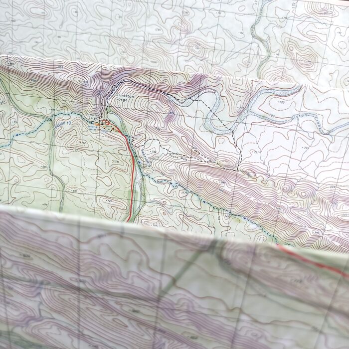
Larapinta Trail Map
West MacDonnell Ranges and the Larapinta Trail is a four-part topographic trail map for Central Australia’s iconic Larapinta Trail.
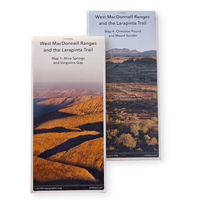
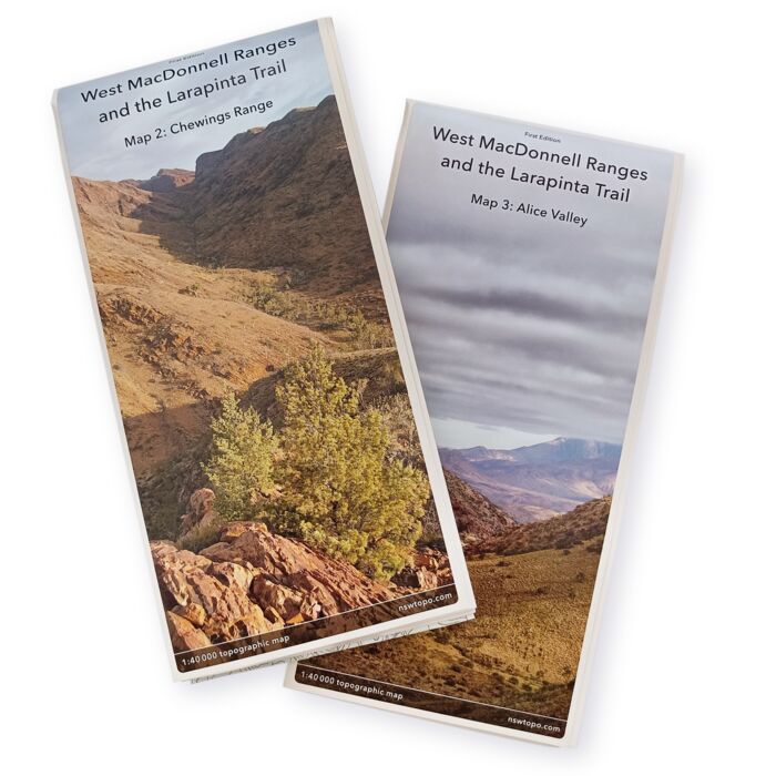
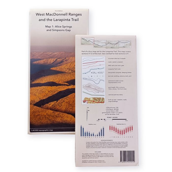
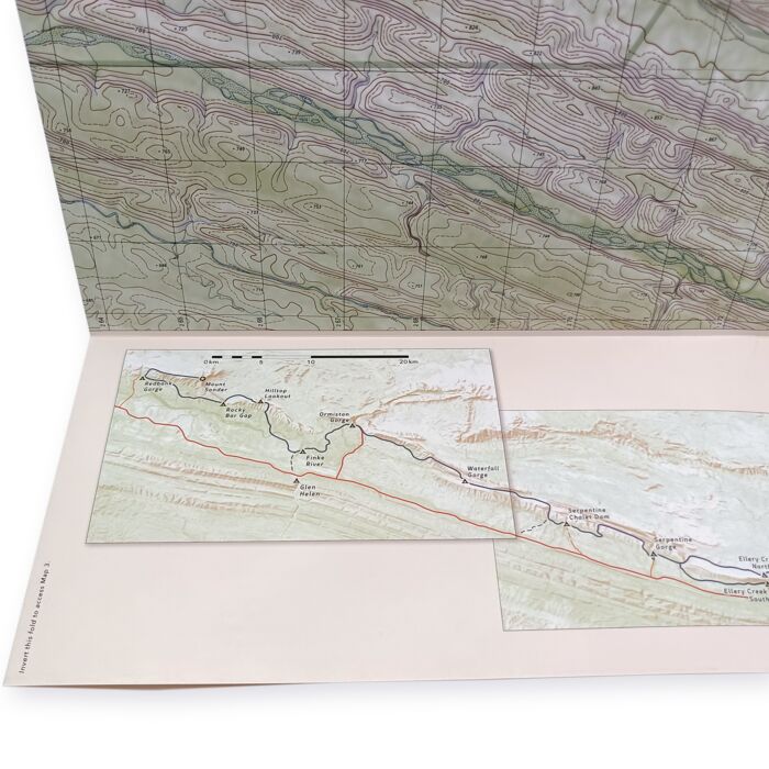
Digital maps are great, but there’s nothing like a fold-out paper map for observing the lay of the land. The West MacDonnell Ranges and the Larapinta Trail map is just what you need when you’re taking on this epic 230 km trail. Features include:
- Four large maps, printed on two sheets of durable, weatherproof synthetic paper.
- Coverage of the entire Larapinta Trail and most of the West MacDonnell Ranges.
- Topographic detail at 1:40 000 scale.
- Locations of all designated campsites and amenities.
- An overview showing major campsites, access points, and your progress along the trail.
- All recent track realignments and new shelters.
- Folded size: 109 mm × 234 mm.
- Unfolded size: 936 mm × 655 mm.
- Weight: 67 g per map, 134 g for the set.
- ISBN: 978-0-6454420-2-1.
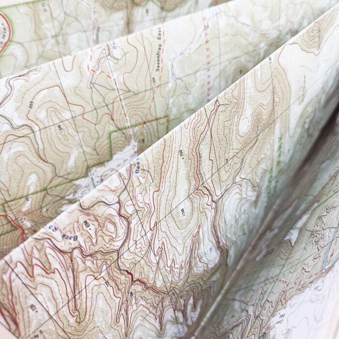
Budawangs Trail Map
The Budawangs: A Bushwalker’s Guide is a comprehensive, two-part topographic trail map for the Budawang Wilderness in the south-east of New South Wales.
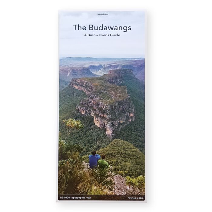
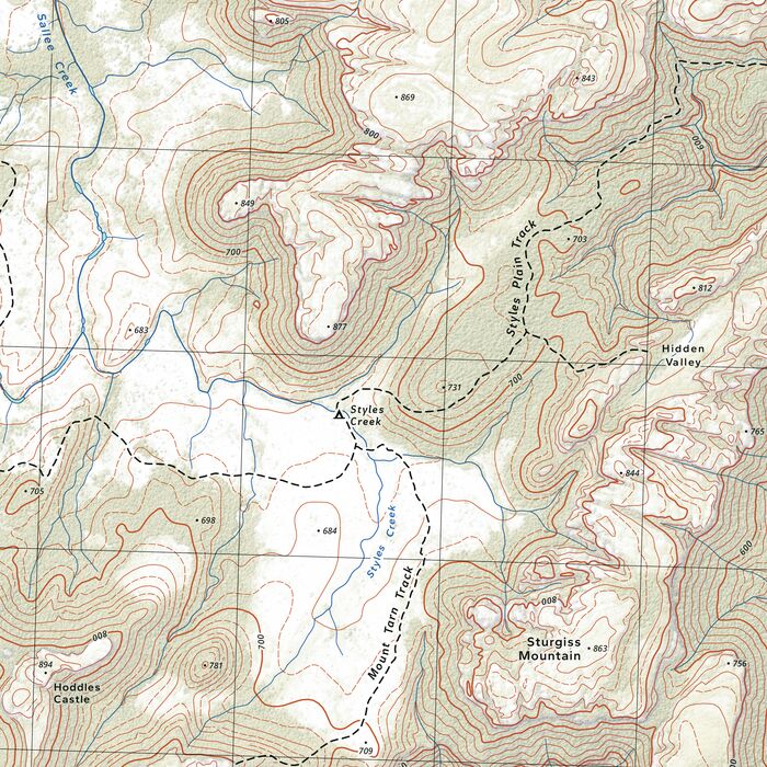
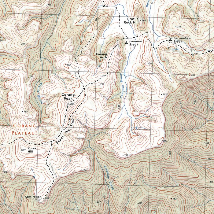
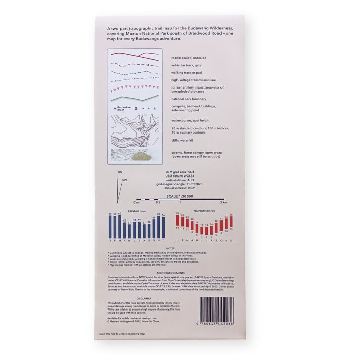
The Budawangs stands as one of Australia’s most spectacular and distinctive wilderness areas. Using modern elevation, vegetation and trail data, The Budawangs finally delivers a map of quality and accuracy befitting this renowned bushwalking destination. Key features include:
- Two large maps, printed back-to-back on durable, weatherproof synthetic paper.
- Extensive coverage equivalent to five standard NSW map sheets.
- Clear marking of frequently used walking tracks and campsites.
- Locations of all trailheads, including Long Gully, Wog Wog, Nerriga, Sassafras, Little Forest Plateau and Pigeon House Mountain.
- Insets for the southernmost peaks of Currockbilly Mountain and Mount Budawang.
- Accurate contours, canopy and vegetation, sourced from high-resolution lidar survey.
- Topographic detail at 1:30 000 scale.
- Folded size: 116 mm × 250 mm.
- Unfolded size: 695 mm × 1000 mm.
- Weight: 64 g.
- ISBN: 978-0-6454420-3-8.
Digital Topographic Maps
We provide a large selection of cheap digital topographic maps for most Australian states. These maps are easy to purchase and use on any iPhone or Android device, using the Avenza Maps app. Maps reside on your device and work without an internet connection.
Find and install the topographic maps you need using the index map below.
Cartographic Software
Our maps are made using in-house, open-source cartographic software. Read more about the software at the nswtopo GitHub page.
Cartographic Services
Using our software, we're able to provide bespoke topographic and other mapping services. We're particularly familiar with NSW data sources, and can readily produce quality maps for rogaines and other events. Contact us at to enquire about a custom topographic map for your next outdoor event.
About Us
I’m a self-taught cartographer with a love of maps and the landscapes they represent. I’m also a programmer, and found that these two areas have a fascinating intersection in the field of geospatial software.
I first developed map-making software for the navigational sport of rogaining. While improving the software, I began creating statewide topographic map series for use with smartphones. I’ve now diversified into printed maps—a more traditional pursuit which benefits greatly from modern tools and data.
In my printed maps, I aim to provide an optimal balance of detail and coverage, with no space wasted and an eye to aesthetics. I hope they’ll be a great addition to your kit.
- Contact us at for after-sales support and commercial enquiries.
- See our terms of service.
- ABN 38 719 828 657